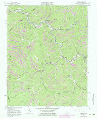
1963 Map of Harman
USGS Topo · Published 1984About this map
The Levisa Fork carves a deep path through the heart of Buchanan County, Virginia, and Pike County, Kentucky, dictating the development of the region's coal-driven economy. In the early 1960s, the Norfolk and Western railroad tracks followed the river's winding curves, connecting mountain settlements like Big Rock, Weller, and Harman Junction. The landscape is defined by its industrial activity, with numerous Strip Mines and gaging stations supporting the extraction and transport of mineral wealth. Evidence of established local communities is found in the many small schools and churches, such as Home Creek Sch and Looney Creek Ch. These labels, alongside family-named landmarks like Caney Island Br and Elijah Branch, reveal a dense network of mountain life clustered in the narrow valleys and hollows between high ridges like Conaway Gap and Hoot Owl Gap.
Find a feature on this map
81 named features on this map. Tap any name to fly to it.
Don’t see what you’re looking for? This feature index may not catch every label — zoom into the map to look around manually.
Map Details
Editions of this 1963 Harman Map
4 editions found
Other maps of this area

1886 · Grundy
USGS Topo · 1:125,000

1890 · Grundy
USGS Topo · 1:125,000

1892 · Grundy
USGS Topo · 1:125,000

1913 · Clintwood
USGS Topo · 1:62,500

1914 · Bucu
USGS Topo · 1:48,000

1914 · Hurley
USGS Topo · 1:48,000

1915 · Clintwood
USGS Topo · 1:62,500

1915 · Regina
USGS Topo · 1:48,000

1915 · Hurley
USGS Topo · 1:48,000

1916 · Bucu
USGS Topo · 1:62,500