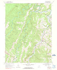
1968 Map of Harman
USGS Topo · Published 1990About this map
DRY Fork and its numerous tributaries, including Laurel Fork and Glady Fork, carve a complex drainage network through this portion of the Monongahela National Forest. The landscape is defined by massive ridges such as Shavers Mountain and Dry Fork Mountain, where narrow valleys host isolated settlements like Harman and Jenningston. This 1960s survey illustrates a remote mountain economy centered on small-scale extraction and conservation, evidenced by a Quarry near Three Spring Run and several Gas Wells. For genealogists, the map preserves specific burial sites like Kerns Cem and White Cem, along with family-named terrain features such as Taylor Eliza Run and Coon Bone Island. The southeastern corner introduces the Spruce Knob-Seneca Rocks National Recreation Area, marking a transition toward managed federal recreation lands during the mid-20th century.
Find a feature on this map
58 named features on this map. Tap any name to fly to it.
Don’t see what you’re looking for? This feature index may not catch every label — zoom into the map to look around manually.
Map Details
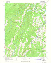
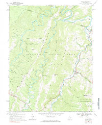
Editions of this 1968 Harman Map
3 editions found
Other maps of this area

1886 · St. George
USGS Topo · 1:125,000

1889 · Beverly
USGS Topo · 1:125,000

1891 · St. George
USGS Topo · 1:125,000

1892 · Beverly
USGS Topo · 1:125,000

1892 · Franklin
USGS Topo · 1:125,000

1895 · Piedmont
USGS Topo · 1:125,000

1896 · Franklin
USGS Topo · 1:125,000

1908 · Parsons
USGS Topo · 1:62,500

1916 · Davis
USGS Topo · 1:48,000

1918 · Davis
USGS Topo · 1:62,500