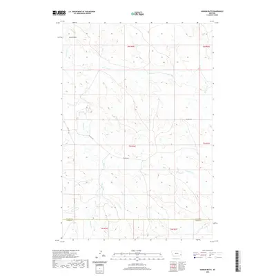
2020 Map of Harmon Butte
USGS Topo · Published 2020About this map
Harmon Butte rises above an intricate network of drainages that define the landscape where Fallon Co meets Carter Co in eastern Montana. This area is characterized by a dense system of seasonal and perennial waterways, including the winding O'Fallon Cr and Lame Jones Cr, which cut through the high plains. The transport infrastructure is sparse, relying on a grid of rural routes such as Willard Rd W and Ismay Rd S to navigate the undulating terrain.
Find a feature on this map
18 named features on this map. Tap any name to fly to it.
Don’t see what you’re looking for? This feature index may not catch every label — zoom into the map to look around manually.
Map Details
Editions of this 2020 Harmon Butte Map
This is the sole edition of this map. No revisions or reprints were ever made.
Other maps of this area

1953 · Miles City
USGS Topo · 1:250,000

1957 · Miles City
USGS Topo · 1:250,000

1958 · Miles City
USGS Topo · 1:250,000

1981 · Baker
USGS Topo · 1:100,000
1981 · Skunk Creek
USGS Topo · 1:24,000

1981 · Harmon Butte
USGS Topo · 1:24,000

1981 · Nelson Butte
USGS Topo · 1:24,000

1981 · Little Pine Creek
USGS Topo · 1:24,000

1981 · Bracket Butte SE
USGS Topo · 1:24,000

1981 · Seven-Up Butte
USGS Topo · 1:24,000