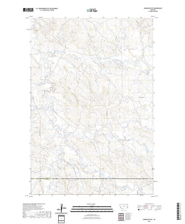
2024 Map of Harmon Butte
USGS Topo · Published 2024About this map
O'Fallon Creek and its many tributaries define this section of the Montana landscape, carving a complex drainage network through the high plains. The terrain is marked by the prominent Harmon Butte, a distinct geographic anchor in the northwest corner of the quadrangle. This 2024 survey captures the rural character of the border between Fallon County and Carter County, where the land is primarily organized by the Public Land Survey System. The map shows a sparse network of local transit, specifically Ismay Rd S and Willard Rd W, which provide the few overland connections across a territory dominated by seasonal waterways like Lame Jones Creek, Milk Creek, and South Fork Milk Creek. These drainage patterns indicate a landscape shaped by intermittent water flow, essential for the ranching and agricultural operations that define this region.
Find a feature on this map
18 named features on this map. Tap any name to fly to it.
Don’t see what you’re looking for? This feature index may not catch every label — zoom into the map to look around manually.
Map Details
Editions of this 2024 Harmon Butte Map
This is the sole edition of this map. No revisions or reprints were ever made.
Other maps of this area

1953 · Miles City
USGS Topo · 1:250,000

1957 · Miles City
USGS Topo · 1:250,000

1958 · Miles City
USGS Topo · 1:250,000

1981 · Baker
USGS Topo · 1:100,000
1981 · Skunk Creek
USGS Topo · 1:24,000

1981 · Harmon Butte
USGS Topo · 1:24,000

1981 · Nelson Butte
USGS Topo · 1:24,000

1981 · Little Pine Creek
USGS Topo · 1:24,000

1981 · Bracket Butte SE
USGS Topo · 1:24,000

1981 · Seven-Up Butte
USGS Topo · 1:24,000