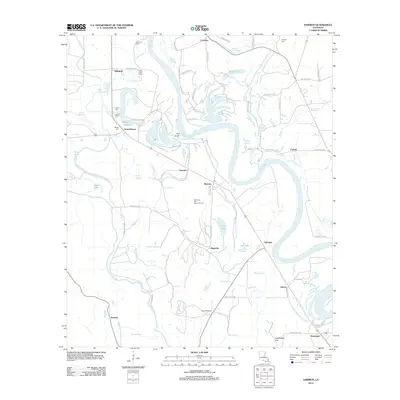
2012 Map of Harmon
USGS Topo · Published 2012About this map
The Red River carves a winding path through this corner of Red River Parish, defining a landscape of active watercourses and industrial pockets. The Red River Bull Bayou Oil Field occupies the central terrain, while small settlements like Harmon and Gahagan line the eastern banks. The western side is characterized by intricate bayous and sloughs, including Bayou Pierre and the expansive Grand Bayou. Local family history is preserved in several small burial grounds such as Tanyard Cem and Morrison Cem, which are scattered throughout the rural landscape. Aviators and transport historians will note the Stuart Airstrip and various named roads like Huckabay Rd. The topography is generally low-lying river bottomland, punctuated by the modest rise of Couchanda Hill near Armistead at the southern edge of the survey area.
Find a feature on this map
74 named features on this map. Tap any name to fly to it.
Don’t see what you’re looking for? This feature index may not catch every label — zoom into the map to look around manually.
Map Details
Editions of this 2012 Harmon Map
This is the sole edition of this map. No revisions or reprints were ever made.
Other maps of this area

1938 · Chemard Lake
USGS Topo · 1:31,680

1938 · Lake End
USGS Topo · 1:31,680

1941 · East Point
USGS Topo · 1:31,680

1941 · Pelican
USGS Topo · 1:62,500

1943 · Pleasant Hill
USGS Topo · 1:62,500

1944 · Pleasant Hill
USGS Topo · 1:62,500

1945 · Mansfield
USGS Topo · 1:62,500

1947 · Mansfield
USGS Topo · 1:62,500

1947 · Hanna
USGS Topo · 1:62,500

1948 · Coushatta
USGS Topo · 1:62,500