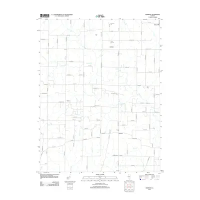
2012 Map of Harmony
USGS Topo · Published 2012About this map
The small settlement of Harmony serves as a central point in this rural Illinois landscape, which is defined by a dense network of country roads and local drainage systems. This 2012 survey illustrates a region where agriculture and energy extraction coexist, specifically through the Divide Oil Field and East Divide Oil Field. A significant concentration of burial grounds, including the Old Donoho Prairie Cem and Union Chapel Cem, provides valuable points of reference for genealogists tracing family histories in the vicinity. The terrain is marked by numerous small waterways such as Horse Cr and Panther Fork that feed into larger systems like Sevenmile Cr and Puncheon Cr, illustrating the natural drainage patterns that have influenced land use and road placement throughout the township over generations.
Find a feature on this map
93 named features on this map. Tap any name to fly to it.
Don’t see what you’re looking for? This feature index may not catch every label — zoom into the map to look around manually.
Map Details
Editions of this 2012 Harmony Map
This is the sole edition of this map. No revisions or reprints were ever made.
Other maps of this area

1933 · Mount Vernon
USGS Topo · 1:48,000

1934 · Salem
USGS Topo · 1:62,500

1938 · Salem
USGS Topo · 1:62,500

1940 · Mount Vernon
USGS Topo · 1:62,500

1947 · Wayne City
USGS Topo · 1:62,500

1952 · Xenia
USGS Topo · 1:62,500

1958 · Belleville
USGS Topo · 1:250,000

1962 · Belleville
USGS Topo · 1:250,000

1964 · Opdyke
USGS Topo · 1:24,000

1965 · Iuka
USGS Topo · 1:24,000