
1965 Map of Iuka
USGS Topo · Published 1966About this map
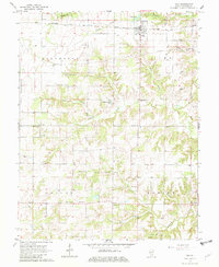
The Baltimore and Ohio railroad corridor anchors this mid-century look at Marion County, following the high ground through the village of Iuka. The landscape transitions from the developed rail siding and residential grid of the town into a network of section roads dotted with rural institutions. Numerous country churches and family burial grounds, including Old Bethel Ch and the Rabbit Grove Cem, indicate a well-established agrarian community. The local economy is visibly shaped by natural resource extraction, evidenced by scattered Oil Wells throughout the northern townships of Stevenson and Iuka. Drainage is defined by numerous winding waterways like Skillet Fork and Old Camp Creek, which carve through the terrain toward the southern settlement of Union Town.
Find a feature on this map
39 named features on this map. Tap any name to fly to it.
Don’t see what you’re looking for? This feature index may not catch every label — zoom into the map to look around manually.
Map Details
Editions of this 1965 Iuka Map
2 editions found
Other maps of this area

1933 · Mount Vernon
USGS Topo · 1:48,000

1934 · Salem
USGS Topo · 1:62,500

1938 · Salem
USGS Topo · 1:62,500

1940 · Mount Vernon
USGS Topo · 1:62,500

1947 · Wayne City
USGS Topo · 1:62,500

1952 · Xenia
USGS Topo · 1:62,500

1958 · Belleville
USGS Topo · 1:250,000

1962 · Belleville
USGS Topo · 1:250,000
1965 · Salem South
USGS Topo · 1:24,000
1965 · Harmony
USGS Topo · 1:24,000