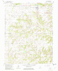
1965 Map of Iuka
USGS Topo · Published 1982About this map
The Baltimore and Ohio railroad corridor anchors this mid-century view of eastern Marion County, cutting through the village of Iuka and defining the local transport patterns. The landscape is a network of small family-centered landmarks, particularly along the drainage of Old Camp Creek and Paintrock Creek. For local historians, the concentration of country churches is remarkable, including Old Bethel Ch, Snowhill Ch, and Elm Grove Ch, many with associated burial grounds like Brawl Cem. The presence of several Oil Wells and a prominent Pipeline running through the Stevenson and Iuka townships indicates the region's mid-century petroleum interests. Farther south, the small settlement of Union Town sits near the confluence of Crooked Creek and Joe Branch, reflecting the enduring rural infrastructure of the era.
Find a feature on this map
35 named features on this map. Tap any name to fly to it.
Don’t see what you’re looking for? This feature index may not catch every label — zoom into the map to look around manually.
Map Details
Editions of this 1965 Iuka Map
2 editions found
Other maps of this area

1933 · Mount Vernon
USGS Topo · 1:48,000

1934 · Salem
USGS Topo · 1:62,500

1938 · Salem
USGS Topo · 1:62,500

1940 · Mount Vernon
USGS Topo · 1:62,500

1947 · Wayne City
USGS Topo · 1:62,500

1952 · Xenia
USGS Topo · 1:62,500

1958 · Belleville
USGS Topo · 1:250,000

1962 · Belleville
USGS Topo · 1:250,000

1965 · Iuka
USGS Topo · 1:24,000
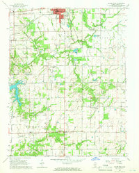
1965 · Salem South
USGS Topo · 1:24,000