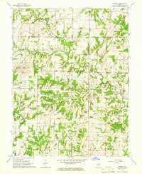
1965 Map of Harmony
USGS Topo · Published 1966About this map
Harmony sits at the center of this rural landscape where the Marion Co Jefferson Co line bisects a terrain of winding waterways and family landmarks. The mid-1960s survey reveals a dispersed community structure tied to local institutions such as Field Sch, Farrington Sch, and the Townhall. Numerous small burial grounds, including the Blankenship Cem, Byars Cem, and Old Donoho Cem, are scattered throughout the townships of Haines, Romine, and Field, providing vital leads for genealogists. The presence of Oil Wells and a Radio Tower indicates the localized industrial developments of the era. The land is drained by several named branches, notably Horse Creek, Sully Creek, and Pigeon Creek, which carve through the Divide separating these southern Illinois townships.
Find a feature on this map
35 named features on this map. Tap any name to fly to it.
Don’t see what you’re looking for? This feature index may not catch every label — zoom into the map to look around manually.
Map Details
Editions of this 1965 Harmony Map
This is the sole edition of this map. No revisions or reprints were ever made.
Other maps of this area

1933 · Mount Vernon
USGS Topo · 1:48,000

1934 · Salem
USGS Topo · 1:62,500

1938 · Salem
USGS Topo · 1:62,500

1940 · Mount Vernon
USGS Topo · 1:62,500

1947 · Wayne City
USGS Topo · 1:62,500

1952 · Xenia
USGS Topo · 1:62,500

1958 · Belleville
USGS Topo · 1:250,000

1962 · Belleville
USGS Topo · 1:250,000

1964 · Opdyke
USGS Topo · 1:24,000

1965 · Iuka
USGS Topo · 1:24,000