
1972 Map of Harmony
USGS Topo · Published 1974About this map
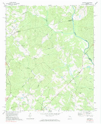
The Oconee River defines the eastern boundary of this rural Putnam County landscape, where the wooded hills meet the river’s winding course. This early 1970s survey documents a region structured by small agricultural communities and traditional country sanctuaries. Significant local landmarks include Harmony, Rudden, and a network of rural churches like Henderson Grove Ch and New Bethel Ch, which served as the social anchors for these upland farms. Much of the western portion of the quadrangle is preserved within the Oconee National Forest, featuring a dense network of creek branches such as Little Sugar Creek, Lick Creek, and Highlog Branch. The map also captures modern infrastructure cutting through the terrain, including a prominent Pipeline and a water tank, while documenting old homesteads and several small cemeteries that provide vital records for family historians studying the Piedmont region.
Find a feature on this map
26 named features on this map. Tap any name to fly to it.
Don’t see what you’re looking for? This feature index may not catch every label — zoom into the map to look around manually.
Map Details
Editions of this 1972 Harmony Map
Other maps of this area

1953 · Athens
USGS Topo · 1:250,000

1958 · Athens
USGS Topo · 1:250,000

1959 · Athens
USGS Topo · 1:250,000

1963 · Athens
USGS Topo · 1:250,000

1972 · Liberty
USGS Topo · 1:24,000

1972 · Meda
USGS Topo · 1:24,000

1972 · Eatonton
USGS Topo · 1:24,000

1972 · Buckhead
USGS Topo · 1:24,000

1972 · Rock Eagle Lake
USGS Topo · 1:24,000
1972 · Madison
USGS Topo · 1:24,000