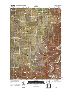
2011 Map of Harmony
USGS Topo · Published 2011About this map
The John Day River carves a winding path through this corner of Sherman County, creating dramatic geographical features like the sharp meander known as The Gooseneck. This landscape is defined by its deep drainages and isolated settlements, with the high plateau broken by numerous named ravines such as Ferry Canyon, Bruckert Canyon, and Dipping Vat Canyon. In the northern and western sections, the rural outposts of Monkland and Harmony sit within a grid of local routes like Hay Canyon Rd and Higley Loop. This 2011 survey records a network of vital water sources in an otherwise arid environment, including Kenny Spring and Willow Spring. The convergence of complex topography and sparse homesteading is further evidenced by landmarks like Horseshoe Falls and Owens Basin, illustrating the challenges and reliance on natural springs that have historically shaped land use in this part of eastern Oregon.
Find a feature on this map
25 named features on this map. Tap any name to fly to it.
Don’t see what you’re looking for? This feature index may not catch every label — zoom into the map to look around manually.
Map Details
Editions of this 2011 Harmony Map
This is the sole edition of this map. No revisions or reprints were ever made.
Other maps of this area

1916 · Arlington
USGS Topo · 1:125,000

1916 · Condon
USGS Topo · 1:125,000

1953 · The Dalles
USGS Topo · 1:250,000

1956 · The Dalles
USGS Topo · 1:250,000

1957 · The Dalles
USGS Topo · 1:250,000

1957 · Wasco
USGS Topo · 1:62,500

1964 · Mc Donald
USGS Topo · 1:24,000

1970 · Indian Cove
USGS Topo · 1:24,000

1970 · Rosebush
USGS Topo · 1:24,000
1970 · Esau Canyon
USGS Topo · 1:24,000