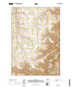
2020 Map of Harmony
USGS Topo · Published 2020About this map
The settlement of Harmony sits amidst a complex network of drainage basins and deep incisions into the Columbia Plateau, as recorded in this 2020 topographic survey. The eastern boundary of the quadrangle is defined by the winding course of the John Day River, which forms the border between Sherman Co and Gilliam Co. This area is characterized by high-relief terrain featuring numerous named canyons, including Hay Canyon and Cottonwood Canyon, and the distinctive river meander known as The Gooseneck.
Find a feature on this map
28 named features on this map. Tap any name to fly to it.
Don’t see what you’re looking for? This feature index may not catch every label — zoom into the map to look around manually.
Map Details
Editions of this 2020 Harmony Map
This is the sole edition of this map. No revisions or reprints were ever made.
Other maps of this area

1916 · Arlington
USGS Topo · 1:125,000

1916 · Condon
USGS Topo · 1:125,000

1953 · The Dalles
USGS Topo · 1:250,000

1956 · The Dalles
USGS Topo · 1:250,000

1957 · The Dalles
USGS Topo · 1:250,000

1957 · Wasco
USGS Topo · 1:62,500

1964 · Mc Donald
USGS Topo · 1:24,000

1970 · Indian Cove
USGS Topo · 1:24,000

1970 · Rosebush
USGS Topo · 1:24,000
1970 · Esau Canyon
USGS Topo · 1:24,000