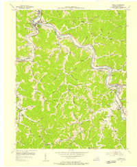
1954 Map of Harold
USGS Topo · Published 1955About this map
Levisa Fork winds through this coal-country landscape, serving as a primary corridor for the Chesapeake and Ohio railroad. In the mid-1950s, the region was defined by small riverside and creek-side settlements like Betsy Layne, Banner, and Ivel. This survey reflects a period of intensive local development, evidenced by the numerous mountain hollows populated with institutions such as Sammy Clark Sch and Amba Chapel. The proximity of the Printer (Salisbury Sta) and Beaver Junction highlight the area's historical reliance on rail infrastructure for both passenger travel and industrial transport.
Find a feature on this map
86 named features on this map. Tap any name to fly to it.
Don’t see what you’re looking for? This feature index may not catch every label — zoom into the map to look around manually.
Map Details
Editions of this 1954 Harold Map
2 editions found
Other maps of this area

1886 · Prestonsburg
USGS Topo · 1:125,000

1890 · Whitesburg
USGS Topo · 1:125,000

1892 · Whitesburg
USGS Topo · 1:125,000

1892 · Prestonsburg
USGS Topo · 1:125,000

1912 · Hindman
USGS Topo · 1:48,000

1914 · Laynesville
USGS Topo · 1:48,000

1914 · Vergie
USGS Topo · 1:48,000

1915 · Prestonsburg
USGS Topo · 1:62,500

1915 · Hindman
USGS Topo · 1:62,500

1916 · Harold
USGS Topo · 1:62,500