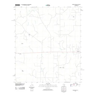
2010 Map of Harper West
USGS Topo · Published 2010About this map
The Pedernales River meanders across this rural landscape, marking a terrain defined by ranching infrastructure and intermittent watercourses. In this part of the Texas Hill Country, the western edge of Harper serves as a hub for a network of local roads that connect dispersed homesteads. The importance of groundwater management is evident through the naming of several specific sites such as Priess Pasture Windmill and Bur Oak Windmill, which highlight the lineage of land use in Gillespie County.
Find a feature on this map
14 named features on this map. Tap any name to fly to it.
Don’t see what you’re looking for? This feature index may not catch every label — zoom into the map to look around manually.
Map Details
Editions of this 2010 Harper West Map
This is the sole edition of this map. No revisions or reprints were ever made.
Other maps of this area

1894 · Kerrville
USGS Topo · 1:125,000

1954 · Llano
USGS Topo · 1:250,000

1955 · Llano
USGS Topo · 1:250,000

1956 · Llano
USGS Topo · 1:250,000

1964 · Nott Branch
USGS Topo · 1:24,000
1964 · Contrary Creek
USGS Topo · 1:24,000
1964 · Mountain Home
USGS Topo · 1:24,000
1967 · Harper East
USGS Topo · 1:24,000
1967 · Doss
USGS Topo · 1:24,000
1974 · Noxville
USGS Topo · 1:24,000