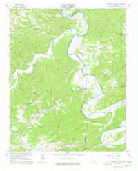
1966 Map of Harpeth Valley
USGS Topo · Published 1977About this map
The Harpeth River carves a winding path through the borderlands of Cheatham and Dickson Counties, forming dramatic loops such as Collier Bend and Johnson Bend. This 1966 field-checked landscape shows a region defined by its narrow valleys and prominent ridges, including the extensive Harpeth Ridge and Sampson Ridge. Small rural settlements like Petway and Griffintown are connected by a network of winding roads, including Griffintown Road and Ashland City Road, which follow the contours of the drainage systems.
Find a feature on this map
58 named features on this map. Tap any name to fly to it.
Don’t see what you’re looking for? This feature index may not catch every label — zoom into the map to look around manually.
Map Details
Editions of this 1966 Harpeth Valley Map
3 editions found
Other maps of this area

1930 · White Bluff
USGS Topo · 1:62,500

1933 · White Bluff
USGS Topo · 1:62,500

1936 · Burns
USGS Topo · 1:24,000

1953 · Burns
USGS Topo · 1:24,000

1956 · Nashville
USGS Topo · 1:250,000

1957 · Cheatham Dam
USGS Topo · 1:24,000

1957 · Ashland City
USGS Topo · 1:24,000

1958 · Charlotte
USGS Topo · 1:24,000

1958 · Cumberland Furnace
USGS Topo · 1:24,000

1959 · Nashville
USGS Topo · 1:250,000