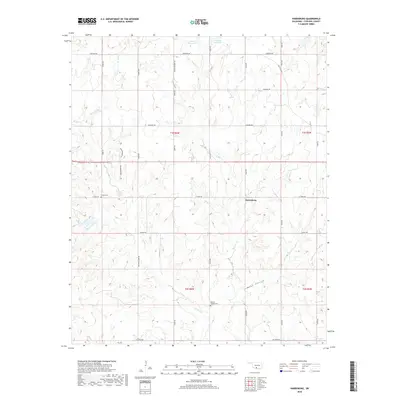
2018 Map of Harrisburg
USGS Topo · Published 2018About this map
Harrisburg stands as the central point of reference in this part of Stephens County, where the landscape is defined by a dendritic network of drainage including W Mud Cr, E Mud Cr, and W Fish Cr. The terrain is characterized by the distinct Weed Hollow and a series of rural road networks that follow the Public Land Survey System grid. Cultural landmarks essential for genealogical research are present, notably Stoner Cem located along E Terry Rd and Weaver Chapel Cem situated further south. This 2018 survey reveals a modern rural infrastructure where old routes like Old State Hwy 7 intersect with locally named roads such as Wesley Beavers Rd and Gaddis Rd, reflecting the long-standing family and community footprints in this Oklahoma corridor.
Find a feature on this map
34 named features on this map. Tap any name to fly to it.
Don’t see what you’re looking for? This feature index may not catch every label — zoom into the map to look around manually.
Map Details
Editions of this 2018 Harrisburg Map
This is the sole edition of this map. No revisions or reprints were ever made.
Other maps of this area

1901 · Addington
USGS Topo · 1:125,000

1902 · Rush Springs
USGS Topo · 1:125,000

1950 · Marlow
USGS Topo · 1:62,500

1951 · Marlow
USGS Topo · 1:62,500

1957 · Ardmore
USGS Topo · 1:250,000

1963 · Ardmore
USGS Topo · 1:250,000

1963 · Harrisburg
USGS Topo · 1:24,000

1964 · Comanche SE
USGS Topo · 1:24,000

1964 · Duncan South
USGS Topo · 1:24,000

1964 · Comanche
USGS Topo · 1:24,000