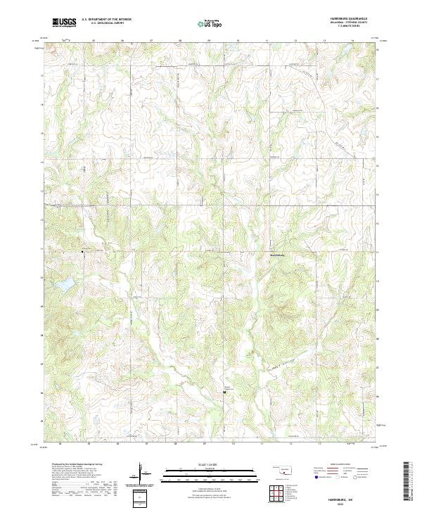
2022 Map of Harrisburg
USGS Topo · Published 2022About this map
The small settlement of Harrisburg sits at the center of this rural Oklahoma landscape, where the headwaters of E Mud Cr and W Mud Cr carve through the terrain. The map captures a region defined by agricultural sections and a network of gravel and section-line roads, including the uniquely named Dr Pepper Rd and Wesley Beavers Rd. The land is dotted with markers of early community life, such as the Stoner Cem and Weaver Chapel Cem, the latter situated near the winding path of Weaver Chapel Rd.
Find a feature on this map
33 named features on this map. Tap any name to fly to it.
Don’t see what you’re looking for? This feature index may not catch every label — zoom into the map to look around manually.
Map Details
Editions of this 2022 Harrisburg Map
This is the sole edition of this map. No revisions or reprints were ever made.
Other maps of this area

1901 · Addington
USGS Topo · 1:125,000

1902 · Rush Springs
USGS Topo · 1:125,000

1950 · Marlow
USGS Topo · 1:62,500

1951 · Marlow
USGS Topo · 1:62,500

1957 · Ardmore
USGS Topo · 1:250,000

1963 · Ardmore
USGS Topo · 1:250,000

1963 · Harrisburg
USGS Topo · 1:24,000

1964 · Comanche SE
USGS Topo · 1:24,000

1964 · Duncan South
USGS Topo · 1:24,000

1964 · Comanche
USGS Topo · 1:24,000