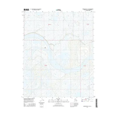
2016 Map of Harrison Bay A-3 SE
USGS Topo · Published 2016About this map
The Colville River dominates this Arctic landscape, carving a wide, braided path through the coastal plain of the North Slope. A significant geographic marker, Ocean Point stands along the riverbank, representing a key landmark in a region defined by expansive wetlands and shifting alluvial deposits. This survey captures the intricate network of channels and ponds that characterize the tundra before the river meets the Beaufort Sea. The map's detailed hydrography illustrates the seasonal nature of the Arctic environment, where the land and water are constantly reshaped by ice and flow. While predominantly a wilderness area, the inclusion of the Public Land Survey System boundaries, such as t9n r3e and t8n r4e, provides an essential framework for land management and environmental study in this remote northern territory.
Find a feature on this map
6 named features on this map. Tap any name to fly to it.
Don’t see what you’re looking for? This feature index may not catch every label — zoom into the map to look around manually.
Map Details
Editions of this 2016 Harrison Bay A-3 SE Map
This is the sole edition of this map. No revisions or reprints were ever made.
Other maps of this area

1951 · Harrison Bay
USGS Topo · 1:250,000

1952 · Umiat
USGS Topo · 1:250,000

1955 · Harrison Bay
USGS Topo · 1:250,000

1955 · Umiat D-2
USGS Topo · 1:63,360

1955 · Harrison Bay A-2
USGS Topo · 1:63,360

1955 · Harrison Bay A-3
USGS Topo · 1:63,360

1955 · Umiat D-3
USGS Topo · 1:63,360

1956 · Umiat
USGS Topo · 1:250,000

1964 · Umiat
USGS Topo · 1:250,000
2013 · Umiat D-3 NW
USGS Topo · 1:25,000