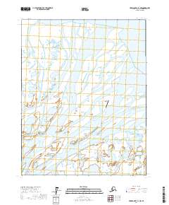
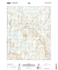
2017 Map of Harrison Bay B-1 NW
USGS Topo · Published 2017About this map
The Colville River delta dominates this landscape on the northern edge of the North Slope, where the river's freshwater outflow meets the Beaufort Sea at Harrison Bay. The intricate network of braided waterways and alluvial deposits is anchored by large landforms such as Anachlik Island and Nuekshat Island. These islands, separated by the deep Kupigruak Channel, illustrate the shifting geography of one of the world's largest Arctic delta systems.
Find a feature on this map
10 named features on this map. Tap any name to fly to it.
Don’t see what you’re looking for? This feature index may not catch every label — zoom into the map to look around manually.
Map Details
Editions of this 2017 Harrison Bay B-1 NW Map
This is the sole edition of this map. No revisions or reprints were ever made.
Other maps of this area

1951 · Harrison Bay
USGS Topo · 1:250,000

1955 · Harrison Bay
USGS Topo · 1:250,000

1955 · Harrison Bay C-1
USGS Topo · 1:63,360

1955 · Harrison Bay B-2
USGS Topo · 1:63,360

1955 · Harrison Bay B-1
USGS Topo · 1:63,360
1962 · Harrison Bay B-1
USGS Topo · 1:50,000
1962 · Harrison Bay B-2
USGS Topo · 1:50,000
1962 · Harrison Bay C-1
USGS Topo · 1:50,000
2017 · Harrison Bay B-1 SW
USGS Topo · 1:25,000
2017 · Harrison Bay C-2 SW
USGS Topo · 1:25,000