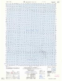
1962 Map of Harrison Bay C-1
USGS Topo · Published 1962About this map
Thetis Island sits as a lonely marker along the northern Alaskan coast in this mid-century maritime survey. The Beaufort Sea dominates the upper portion of the sheet, where soundings in fathoms reveal the shallow, shifting nature of the arctic shelf. To the south, the waters of Harrison Bay stretch toward the mainland, characterized by tidal flats and mud-sand compositions. Compiled from photogrammetric methods and coastal hydrography by the Army Map Service, this map serves as a precise technical study of an area where the boundary between sea and tundra is constantly redefined by ice and tide. The lack of terrestrial settlements emphasizes the isolation of this North Slope environment, where the primary features are the submerged hazards and bathymetric contours essential for coastal navigation.
Find a feature on this map
4 named features on this map. Tap any name to fly to it.
Don’t see what you’re looking for? This feature index may not catch every label — zoom into the map to look around manually.
Map Details
Editions of this 1962 Harrison Bay C-1 Map
This is the sole edition of this map. No revisions or reprints were ever made.
Other maps of this area

1951 · Harrison Bay
USGS Topo · 1:250,000

1951 · Beechey Point
USGS Topo · 1:250,000

1955 · Harrison Bay
USGS Topo · 1:250,000

1955 · Beechey Point
USGS Topo · 1:250,000

1955 · Harrison Bay C-1
USGS Topo · 1:63,360

1955 · Harrison Bay B-2
USGS Topo · 1:63,360

1955 · Harrison Bay B-1
USGS Topo · 1:63,360
1955 · Beechey Point C-5
USGS Topo · 1:63,360

1955 · Beechey Point B-5
USGS Topo · 1:63,360

1960 · Beechey Point
USGS Topo · 1:250,000