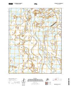
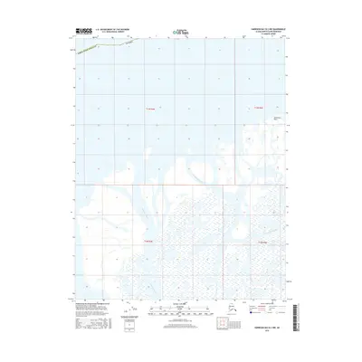
2020 Map of Harrison Bay B-2 SW
USGS Topo · Published 2020About this map
Alpine stands as a central point of activity within the intricate Colville River Delta, situated near the Alpine Airstrip on the North Slope. This landscape is defined by its complex hydrography, where the Nechelik Channel and Sakoonang Channel carve through a terrain saturated with wetlands and small water bodies. The presence of Oil Lake and Nanuk Lake highlights the specific environmental and industrial character of this region, where resource extraction infrastructure intersects with the fragile delta ecosystem. The map reveals the organized grid of the Public Land Survey System, including t11n r4e and t12n r5e, overlaid upon a wilderness of shifting channels and seasonal thaw lakes, illustrating the modern management of one of the most northern reaches of the United States.
Find a feature on this map
12 named features on this map. Tap any name to fly to it.
Don’t see what you’re looking for? This feature index may not catch every label — zoom into the map to look around manually.
Map Details
Editions of this 2020 Harrison Bay B-2 SW Map
This is the sole edition of this map. No revisions or reprints were ever made.
Other maps of this area

1951 · Harrison Bay
USGS Topo · 1:250,000

1955 · Harrison Bay
USGS Topo · 1:250,000

1955 · Harrison Bay B-3
USGS Topo · 1:63,360

1955 · Harrison Bay B-2
USGS Topo · 1:63,360

1955 · Harrison Bay A-2
USGS Topo · 1:63,360

1955 · Harrison Bay A-3
USGS Topo · 1:63,360
1962 · Harrison Bay B-2
USGS Topo · 1:50,000
1962 · Harrison Bay B-3
USGS Topo · 1:50,000
2013 · Harrison Bay A-3 NE
USGS Topo · 1:25,000
2016 · Harrison Bay B-2 NW
USGS Topo · 1:25,000