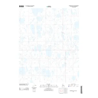
2013 Map of Harrison Bay B-5 NW
USGS Topo · Published 2013About this map
The Arctic coastal plain of the North Slope appears as a dense, intricate network of thaw lakes and ponds in this early 21st-century USGS survey. This particular quadrant, located within the T 13 N T 12 N township boundary, showcases the unique thermokarst topography typical of the Alaskan tundra, where permafrost dynamics shape a landscape dominated more by water than by solid ground. The alignment of the water bodies suggests the prevailing environmental forces at work in this remote region. While devoid of permanent human settlements or structures, the map captures the precise hydrographic state of the land at a specific moment in time. The Public Land Survey System markers, such as the R 4 W R 3 W range line, provide the only geometric overlay on an otherwise fluid and organic wilderness, offering a essential reference for environmental researchers or those tracking changes in the northern landscape.
Find a feature on this map
2 named features on this map. Tap any name to fly to it.
Don’t see what you’re looking for? This feature index may not catch every label — zoom into the map to look around manually.
Map Details
Editions of this 2013 Harrison Bay B-5 NW Map
This is the sole edition of this map. No revisions or reprints were ever made.
Other maps of this area

1951 · Harrison Bay
USGS Topo · 1:250,000

1951 · Teshekpuk
USGS Topo · 1:250,000

1955 · Harrison Bay
USGS Topo · 1:250,000

1955 · Teshekpuk
USGS Topo · 1:250,000

1955 · Teshekpuk B-1
USGS Topo · 1:63,360

1955 · Harrison Bay C-5
USGS Topo · 1:63,360

1955 · Harrison Bay B-5
USGS Topo · 1:63,360
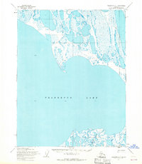
1955 · Teshekpuk C-1
USGS Topo · 1:63,360

1962 · Harrison Bay C-5
USGS Topo · 1:50,000

1964 · Teshekpuk
USGS Topo · 1:250,000