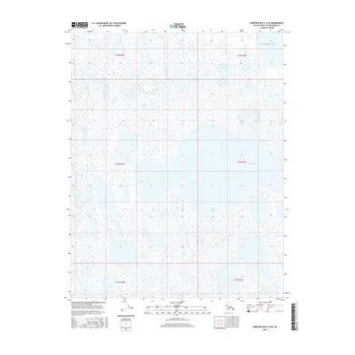
2016 Map of Harrison Bay C-5 SE
USGS Topo · Published 2016About this map
Kogru River meanders through a landscape of saturated coastal wetlands and thermokarst lakes as it approaches the Beaufort Sea. This North Slope terrain is defined by its extreme flatness and intricate water patterns, where the winding river channel eventually meets the expansive waters of Harrison Bay. The map provides a detailed look at the hydraulic complexity of the Alaskan arctic, illustrating how the river system fragments into numerous small bodies of water across the coastal plain. Surveyed in the early twenty-first century, the area remains primarily an intersection of natural water systems and traditional land divisions, with the Public Land Survey System boundaries like t14n r2w and t15n r3w marking the administrative grid across this largely roadless wilderness.
Find a feature on this map
8 named features on this map. Tap any name to fly to it.
Don’t see what you’re looking for? This feature index may not catch every label — zoom into the map to look around manually.
Map Details
Editions of this 2016 Harrison Bay C-5 SE Map
This is the sole edition of this map. No revisions or reprints were ever made.
Other maps of this area

1951 · Harrison Bay
USGS Topo · 1:250,000

1955 · Harrison Bay
USGS Topo · 1:250,000

1955 · Harrison Bay C-5
USGS Topo · 1:63,360

1955 · Harrison Bay B-5
USGS Topo · 1:63,360

1955 · Harrison Bay C-4
USGS Topo · 1:63,360

1955 · Harrison Bay B-4
USGS Topo · 1:63,360

1962 · Harrison Bay C-5
USGS Topo · 1:50,000
2013 · Harrison Bay C-5 SW
USGS Topo · 1:25,000
2013 · Harrison Bay B-5 NE
USGS Topo · 1:25,000
2013 · Harrison Bay B-5 NW
USGS Topo · 1:25,000