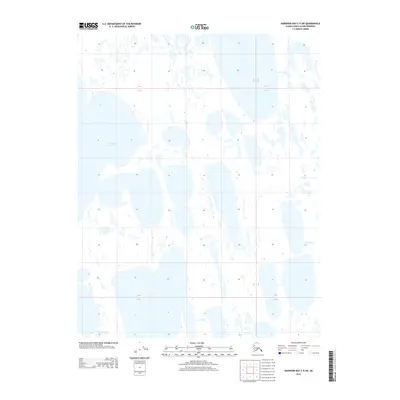
2013 Map of Harrison Bay C-5 SW
USGS Topo · Published 2013About this map
Teshekpuk Lake dominates the northwestern landscape of this Arctic coastal plain, where the hydrology of the North Slope is defined by a dense network of thaw lakes and interconnected wetlands. The southeastern quadrant is marked by the winding course of the Kogru River, a vital drainage system for this tundra environment. In the northeast, Garry Creek flows through the low-lying terrain, illustrating the delicate and shifting water patterns characteristic of the region. This 2013 survey provides a clear view of the complex land-and-water interface in an area shaped by permafrost and seasonal freeze-thaw cycles, documenting the precise extent of major water bodies before subsequent environmental changes.
Find a feature on this map
7 named features on this map. Tap any name to fly to it.
Don’t see what you’re looking for? This feature index may not catch every label — zoom into the map to look around manually.
Map Details
Editions of this 2013 Harrison Bay C-5 SW Map
This is the sole edition of this map. No revisions or reprints were ever made.
Other maps of this area

1951 · Harrison Bay
USGS Topo · 1:250,000

1951 · Teshekpuk
USGS Topo · 1:250,000

1955 · Harrison Bay
USGS Topo · 1:250,000

1955 · Teshekpuk
USGS Topo · 1:250,000

1955 · Teshekpuk B-1
USGS Topo · 1:63,360

1955 · Harrison Bay C-5
USGS Topo · 1:63,360

1955 · Harrison Bay B-5
USGS Topo · 1:63,360
1955 · Teshekpuk C-1
USGS Topo · 1:63,360

1962 · Harrison Bay C-5
USGS Topo · 1:50,000

1964 · Teshekpuk
USGS Topo · 1:250,000