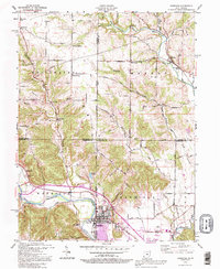
1992 Map of Harrison
USGS Topo · Published 1995About this map
Harrison and West Harrison straddle the state line where the Whitewater River cuts through the southwestern corner of Ohio into Indiana. This landscape is defined by the convergence of several major drainage systems, including the Dry Fork Whitewater River and Howard Creek, which carved the valleys that guided early road networks like the Okeana Drewersburg Road. The map reveals a transition from the denser urban grid of Harrison to the rural townships of Whitewater and Morgan, where small crossroads settlements like Okeana and Alert persist near historic sites such as Township Sch. Genealogy researchers will find several well-marked burial grounds, including Woodlawn Cem and Harrison Cem, while the eastern portion of the sheet is dominated by the sprawling acreage of the Miami Whitewater County Forest Park.
Find a feature on this map
59 named features on this map. Tap any name to fly to it.
Don’t see what you’re looking for? This feature index may not catch every label — zoom into the map to look around manually.
Map Details
Editions of this 1992 Harrison Map
This is the sole edition of this map. No revisions or reprints were ever made.
Other maps of this area

1914 · West Cincinnati
USGS Topo · 1:62,500

1915 · Lawrenceburg
USGS Topo · 1:48,000

1915 · Harrison
USGS Topo · 1:48,000

1915 · Hamilton
USGS Topo · 1:62,500

1917 · Hamilton
USGS Topo · 1:62,500

1928 · Lawrenceburg
USGS Topo · 1:62,500

1932 · Lawrenceburg
USGS Topo · 1:62,500

1943 · Hooven
USGS Topo · 1:24,000

1943 · Guilford
USGS Topo · 1:24,000

1953 · Guilford
USGS Topo · 1:24,000