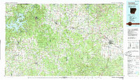
1985 Map of Harrison
USGS Topo · Published 1985About this map
The Ozark plateau of northwest Arkansas and southwest Missouri is defined here by the winding corridors of the White River and the Buffalo National River. In the mid-1980s, the region centers on the growing hub of Harrison, with agricultural and timber communities like Berryville and Green Forest connected by the climbing grades of US Highway 62. The map illustrates a landscape of deep limestone hollows and high points such as Boat Mountain and Gaither Mountain, where narrow ridges separate the drainage of War Eagle Creek from the Kings River. This topography necessitated complex road networks that connect smaller settlements like Ponca, Lead Hill, and the lakeside town of Beaver. Significant protected lands are visible, including the Madison County State Wildlife Management Area and the Ozark National Forest, while the impounded waters of Table Rock Lake and Beaver Lake dominate the northwestern quadrant.
Find a feature on this map
114 named features on this map. Tap any name to fly to it.
Don’t see what you’re looking for? This feature index may not catch every label — zoom into the map to look around manually.
Map Details
Editions of this 1985 Harrison Map
This is the sole edition of this map. No revisions or reprints were ever made.
Other maps of this area

1892 · Marshall
USGS Topo · 1:125,000

1893 · Yellville
USGS Topo · 1:125,000

1894 · Marshall
USGS Topo · 1:125,000

1898 · Winslow
USGS Topo · 1:125,000

1899 · Fayetteville
USGS Topo · 1:125,000

1900 · Eureka Springs
USGS Topo · 1:125,000

1901 · Winslow
USGS Topo · 1:125,000

1901 · Marshall
USGS Topo · 1:125,000

1901 · Eureka Springs
USGS Topo · 1:125,000

1901 · Fayetteville
USGS Topo · 1:125,000