
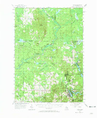
1957 Map of Harrison
USGS Topo · Published 1958About this map
Harrison and its surrounding townships represent a landscape defined by natural resource extraction and rural community life in the late 1950s. The southern portion of the map centers on the county seat and Wilson State Park, while the northern reaches transitions into the dense Houghton Lake State Forest. This period shows a mature petroleum infrastructure, with the Cranberry Lake Oil and Gas Field and Winterfield Oil and Gas Storage Field marking the subterranean economy of central Michigan.
Find a feature on this map
71 named features on this map. Tap any name to fly to it.
Don’t see what you’re looking for? This feature index may not catch every label — zoom into the map to look around manually.
Map Details
Editions of this 1957 Harrison Map
2 editions found
Other maps of this area

1954 · Traverse City
USGS Topo · 1:250,000

1954 · Midland
USGS Topo · 1:250,000

1956 · Houghton Lake
USGS Topo · 1:62,500

1956 · Lake City
USGS Topo · 1:62,500

1957 · Marion
USGS Topo · 1:62,500

1958 · Traverse City
USGS Topo · 1:250,000

1958 · Midland
USGS Topo · 1:250,000

1959 · Midland
USGS Topo · 1:250,000

1959 · Lake
USGS Topo · 1:62,500

1959 · Clare
USGS Topo · 1:62,500