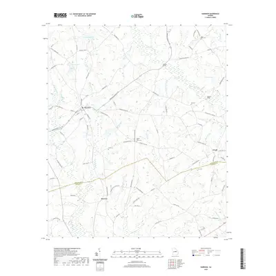
2020 Map of Harrison
USGS Topo · Published 2020About this map
Harrison serves as the primary hub of this rural landscape, defined by its position along the railroad corridors of N Railroad Ave and S Railroad Ave. The town’s layout is deeply intertwined with local commerce and transportation, extending outward toward neighboring settlements like Donovan to the southwest and Pringle in the southeast. This region of the Georgia coastal plain is a network of small watercourses and family-named landmarks, where the Little Ohoopee River and Golden Cr create a complex system of drainage and wetlands.
Find a feature on this map
85 named features on this map. Tap any name to fly to it.
Don’t see what you’re looking for? This feature index may not catch every label — zoom into the map to look around manually.
Map Details
Editions of this 2020 Harrison Map
This is the sole edition of this map. No revisions or reprints were ever made.
Other maps of this area

1957 · Macon
USGS Topo · 1:250,000

1958 · Macon
USGS Topo · 1:250,000

1962 · Irwins Crossroads
USGS Topo · 1:24,000

1962 · Sandersville
USGS Topo · 1:24,000

1964 · Macon
USGS Topo · 1:250,000
1973 · Davisboro SE
USGS Topo · 1:24,000
1973 · Riddleville
USGS Topo · 1:24,000
1973 · Harrison
USGS Topo · 1:24,000

1974 · Kite
USGS Topo · 1:24,000

1974 · Wrightsville
USGS Topo · 1:24,000