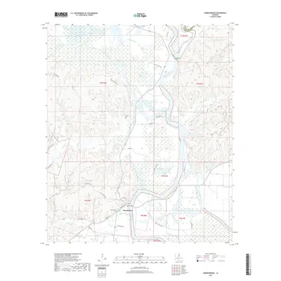
2018 Map of Harrisonburg
USGS Topo · Published 2018About this map
The Ouachita River defines the landscape of this Louisiana quadrangle, winding past the village of Harrisonburg and the riverside settlement at Stafford Point. The river’s path is flanked by a complex network of seasonal waterways and oxbow remnants, including Sargent Lake, Stafford Lake, and Onemile Bayou. This low-lying terrain in the Mississippi alluvial plain is crisscrossed by family-named routes such as L L McGuffee Rd, Horace Patten Rd, and Boothe Cemetary Rd, reflecting the deep-rooted local heritage of Catahoula Parish.
Find a feature on this map
51 named features on this map. Tap any name to fly to it.
Don’t see what you’re looking for? This feature index may not catch every label — zoom into the map to look around manually.
Map Details
Editions of this 2018 Harrisonburg Map
This is the sole edition of this map. No revisions or reprints were ever made.
Other maps of this area

1939 · Red Gum
USGS Topo · 1:62,500

1941 · Manifest
USGS Topo · 1:62,500

1941 · Sicily Island
USGS Topo · 1:62,500

1941 · Harrisonburg
USGS Topo · 1:62,500

1953 · Natchez
USGS Topo · 1:250,000

1956 · Natchez
USGS Topo · 1:250,000

1957 · Sicily Island
USGS Topo · 1:62,500

1959 · Natchez
USGS Topo · 1:250,000

1959 · Harrisonburg
USGS Topo · 1:62,500

1960 · Jonesville
USGS Topo · 1:62,500