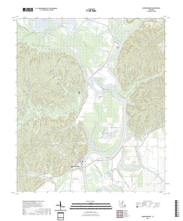
2024 Map of Harrisonburg
USGS Topo · Published 2024About this map
Harrisonburg sits as the central point of this modern topographic study, where the Ouachita River creates a dramatic series of bends and loops including Meyers Bend. The settlement pattern is anchored by the Catahoula Parish Courthouse and historic burial sites such as the Harrisonburg Cem and Boothe Cem. The landscape is a complex network of waterways, where the Boeuf River and Bayou Louis meet the slow-moving waters of Sargent Lake and Lake Slough.
Find a feature on this map
49 named features on this map. Tap any name to fly to it.
Don’t see what you’re looking for? This feature index may not catch every label — zoom into the map to look around manually.
Map Details
Editions of this 2024 Harrisonburg Map
This is the sole edition of this map. No revisions or reprints were ever made.
Other maps of this area

1939 · Red Gum
USGS Topo · 1:62,500

1941 · Manifest
USGS Topo · 1:62,500

1941 · Sicily Island
USGS Topo · 1:62,500

1941 · Harrisonburg
USGS Topo · 1:62,500

1953 · Natchez
USGS Topo · 1:250,000

1956 · Natchez
USGS Topo · 1:250,000

1957 · Sicily Island
USGS Topo · 1:62,500

1959 · Natchez
USGS Topo · 1:250,000

1959 · Harrisonburg
USGS Topo · 1:62,500

1960 · Jonesville
USGS Topo · 1:62,500