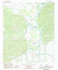
1984 Map of Harrisonburg
USGS Topo · Published 1985About this map
Harrisonburg sits at a critical bend where the Ouachita River snakes through the lowlands of Catahoula Parish. This mid-1980s survey captures a landscape defined by its complex hydrology, where the Boeuf River joins the Ouachita amidst a dense network of sloughs and backwaters. To the east, the rising terrain of the Sicily Island Hills State Wildlife Management Area provides a stark contrast to the alluvial plains. The map records numerous named water bodies that speak to the shifting nature of the river over time, including Gastis Lake, Stafford Lake, and Sargent Lake. These oxbows and bayous, such as Louis Bayou and Kelley Bayou, delineate the historical drainage patterns that shaped local settlement and land use long before the era of modern water management.
Find a feature on this map
28 named features on this map. Tap any name to fly to it.
Don’t see what you’re looking for? This feature index may not catch every label — zoom into the map to look around manually.
Map Details
Editions of this 1984 Harrisonburg Map
This is the sole edition of this map. No revisions or reprints were ever made.
Other maps of this area

1939 · Red Gum
USGS Topo · 1:62,500

1941 · Manifest
USGS Topo · 1:62,500

1941 · Sicily Island
USGS Topo · 1:62,500

1941 · Harrisonburg
USGS Topo · 1:62,500

1953 · Natchez
USGS Topo · 1:250,000

1956 · Natchez
USGS Topo · 1:250,000

1957 · Sicily Island
USGS Topo · 1:62,500

1959 · Natchez
USGS Topo · 1:250,000

1959 · Harrisonburg
USGS Topo · 1:62,500

1960 · Jonesville
USGS Topo · 1:62,500