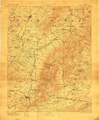
1892 Map of Harrisonburg
USGS Topo · Published 1907About this map
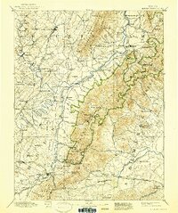
Harrisonburg serves as a central hub in this late 19th-century survey of the Shenandoah Valley, where the Shenandoah Valley Railroad and various county roads converge. The map illustrates a landscape of established agrarian life and early industry, featuring numerous mills such as Crimora Mill and Burke Mill P.O.. The intersection of the South River and North River at Port Republic highlights a significant historic river junction, while nearby Weyer Cave and the Weyer Cave Sta. point to the region's early importance as a destination for travelers.
Find a feature on this map
171 named features on this map. Tap any name to fly to it.
Don’t see what you’re looking for? This feature index may not catch every label — zoom into the map to look around manually.
Map Details
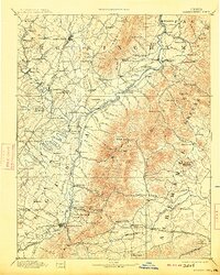
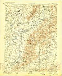
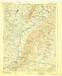
Editions of this 1892 Harrisonburg Map
6 editions found
Other maps of this area

1891 · Palmyra
USGS Topo · 1:125,000

1892 · Buckingham
USGS Topo · 1:125,000

1892 · Franklin
USGS Topo · 1:125,000

1892 · Woodstock
USGS Topo · 1:125,000

1892 · Gordonsville
USGS Topo · 1:125,000

1892 · Harrisonburg
USGS Topo · 1:125,000

1893 · Luray
USGS Topo · 1:125,000

1894 · Staunton
USGS Topo · 1:125,000

1894 · Lexington
USGS Topo · 1:125,000

1895 · Palmyra
USGS Topo · 1:125,000