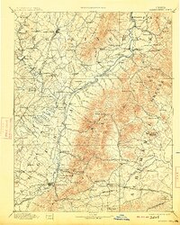
1892 Map of Harrisonburg
USGS Topo · Published 1913About this map
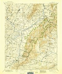
Harrisonburg stands as the primary hub in this late 19th-century survey of the Shenandoah Valley, where the Valley Railroad and Southern Railway intersect amidst a landscape of established farmsteads and rural commerce. The map meticulously records a network of nineteenth-century life, featuring long-gone landmarks such as Meyerhoffers Store and Korner Store, alongside the industrial presence of the Crimora Mine and several saw mills. The terrain is defined by the sharp rise of the Blue Ridge, punctuated by vital gaps like Swift Run Gap and Rock Fish Gap that dictated the flow of trade and travel between the valley and the Piedmont.
Find a feature on this map
160 named features on this map. Tap any name to fly to it.
Don’t see what you’re looking for? This feature index may not catch every label — zoom into the map to look around manually.
Map Details
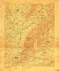
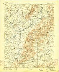
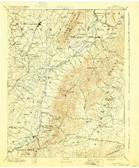
Editions of this 1892 Harrisonburg Map
6 editions found
Other maps of this area

1891 · Palmyra
USGS Topo · 1:125,000

1892 · Buckingham
USGS Topo · 1:125,000

1892 · Franklin
USGS Topo · 1:125,000

1892 · Woodstock
USGS Topo · 1:125,000

1892 · Gordonsville
USGS Topo · 1:125,000

1892 · Harrisonburg
USGS Topo · 1:125,000

1893 · Luray
USGS Topo · 1:125,000

1894 · Staunton
USGS Topo · 1:125,000

1894 · Lexington
USGS Topo · 1:125,000

1895 · Palmyra
USGS Topo · 1:125,000