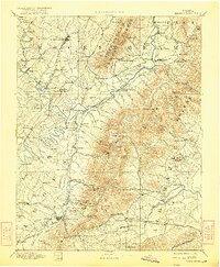
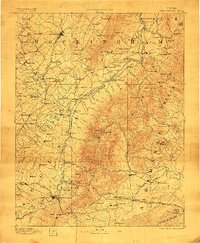
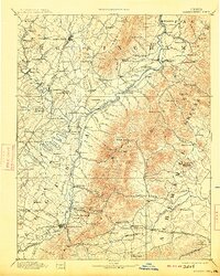
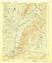
1892 Map of Harrisonburg
USGS Topo · Published 1922About this map
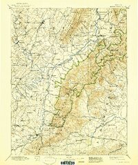
Harrisonburg and its surrounding Shenandoah Valley landscape appear here during a period of significant industrial and transit growth in the late 19th century. The map documents the convergence of the South Fork Shenandoah River and North River at Port Republic, a critical point for local commerce. Industrial operations like the Crimora Mine and Doom Crossing Saw Mill are specifically noted, alongside recreational and scientific landmarks such as Weyer Cave and the University of Virginia Observatory.
Find a feature on this map
149 named features on this map. Tap any name to fly to it.
Don’t see what you’re looking for? This feature index may not catch every label — zoom into the map to look around manually.
Map Details
Editions of this 1892 Harrisonburg Map
6 editions found
Other maps of this area

1891 · Palmyra
USGS Topo · 1:125,000

1892 · Buckingham
USGS Topo · 1:125,000

1892 · Franklin
USGS Topo · 1:125,000

1892 · Woodstock
USGS Topo · 1:125,000

1892 · Gordonsville
USGS Topo · 1:125,000

1892 · Harrisonburg
USGS Topo · 1:125,000

1893 · Luray
USGS Topo · 1:125,000

1894 · Staunton
USGS Topo · 1:125,000

1894 · Lexington
USGS Topo · 1:125,000

1895 · Palmyra
USGS Topo · 1:125,000