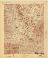
1905 Map of Harrodsburg
USGS Topo · Published 1931About this map
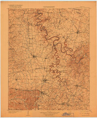
The meandering Kentucky River and its deep palisades define the geography of the Bluegrass region at the dawn of the twentieth century. This survey documents a transition in river navigation and commerce, visible in the system of locks and ferries such as Lock No 7 and the McCowan Ferry that still served as vital crossings. The rugged river corridor is punctuated by engineering landmarks like Highbridge, while the surrounding plateaus are dominated by established agricultural settlements and rail hubs. Local history and genealogy interest is particularly strong around Camp Nelson and Camp Dick Robinson, sites with deep significance in the region's development. The network of the Southern and the Cincinnati New Orleans and Texas Pacific railroads illustrates the importance of transportation in connecting towns like Nicholasville and Wilmore to the wider national economy.
Find a feature on this map
140 named features on this map. Tap any name to fly to it.
Don’t see what you’re looking for? This feature index may not catch every label — zoom into the map to look around manually.
Map Details
Editions of this 1905 Harrodsburg Map
3 editions found
Other maps of this area

1892 · Richmond
USGS Topo · 1:125,000

1893 · London
USGS Topo · 1:125,000

1897 · Richmond
USGS Topo · 1:125,000

1897 · London
USGS Topo · 1:125,000

1905 · Harrodsburg
USGS Topo · 1:125,000

1906 · Georgetown
USGS Topo · 1:62,500

1908 · Georgetown
USGS Topo · 1:62,500

1922 · Frankfort
USGS Topo · 1:48,000

1923 · Waddy
USGS Topo · 1:48,000

1924 · Frankfort
USGS Topo · 1:62,500