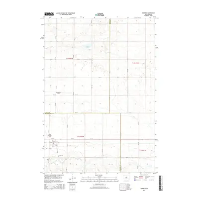
2015 Map of Harrold
USGS Topo · Published 2015About this map
Harrold is the primary settlement on this central South Dakota plains landscape, positioned where the section lines of Hughes and Hyde counties meet. The town's grid is small but defined by named streets like 1st St and 5th St, supported by the presence of the Harrold Municipal Airport to the west. Agriculture and aviation define much of the land use here, with the Bollweg Farm Airport appearing further north. Family history is anchored by the Saint John Cem and Hill Cem, while the natural topography is marked by the S Fork Medicine Knoll Cr and the waters of Walker Lake. The map reveals a highly structured township and range system, typical of the Great Plains, where roads like 321st Ave and 197th St form a rigid lattice across the terrain.
Find a feature on this map
33 named features on this map. Tap any name to fly to it.
Don’t see what you’re looking for? This feature index may not catch every label — zoom into the map to look around manually.
Map Details
Editions of this 2015 Harrold Map
This is the sole edition of this map. No revisions or reprints were ever made.
Other maps of this area

1953 · Huron
USGS Topo · 1:250,000

1954 · Huron
USGS Topo · 1:250,000

1967 · Blunt SE
USGS Topo · 1:24,000

1967 · De Grey NE
USGS Topo · 1:24,000

1967 · Blunt NE
USGS Topo · 1:24,000

1968 · Harrold NW
USGS Topo · 1:24,000

1968 · Harrold
USGS Topo · 1:24,000

1968 · Holabird
USGS Topo · 1:24,000

1968 · Harrold NE
USGS Topo · 1:24,000

1973 · Chapelle Lake
USGS Topo · 1:24,000