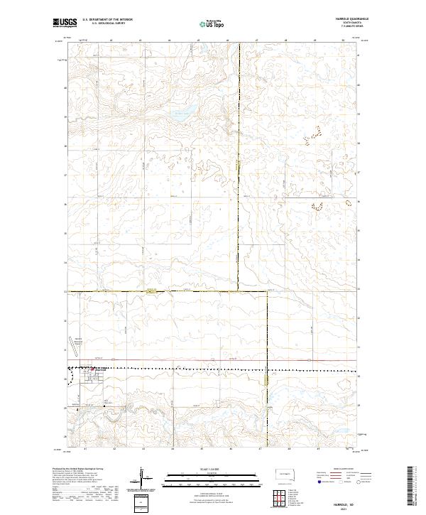
2021 Map of Harrold
USGS Topo · Published 2021About this map
The town of Harrold serves as the central hub of this prairie landscape, where the township lines of t112n r74w and t112n r73w converge in eastern Hughes County. The settlement is defined by its grid of residential streets, including Wyman Ave and 1st St, situated just north of the winding course of the S Fork Medicine Knoll Cr. This modern survey illustrates a transition from established agriculture to regional infrastructure, featuring the Harrold Municipal Airport positioned west of the main town site.
Find a feature on this map
32 named features on this map. Tap any name to fly to it.
Don’t see what you’re looking for? This feature index may not catch every label — zoom into the map to look around manually.
Map Details
Editions of this 2021 Harrold Map
This is the sole edition of this map. No revisions or reprints were ever made.
Other maps of this area

1953 · Huron
USGS Topo · 1:250,000

1954 · Huron
USGS Topo · 1:250,000

1967 · Blunt SE
USGS Topo · 1:24,000

1967 · De Grey NE
USGS Topo · 1:24,000

1967 · Blunt NE
USGS Topo · 1:24,000

1968 · Harrold NW
USGS Topo · 1:24,000

1968 · Harrold
USGS Topo · 1:24,000

1968 · Holabird
USGS Topo · 1:24,000

1968 · Harrold NE
USGS Topo · 1:24,000

1973 · Chapelle Lake
USGS Topo · 1:24,000