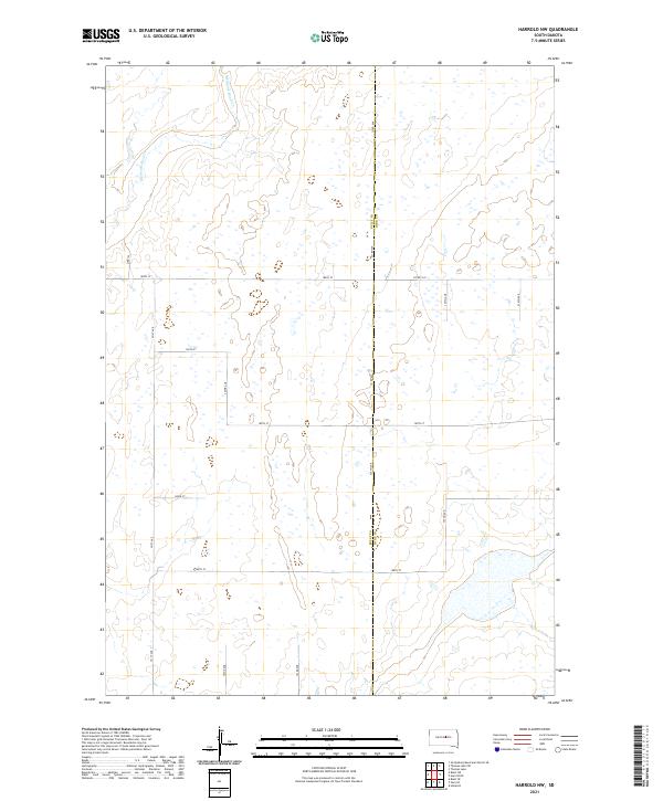
2021 Map of Harrold NW
USGS Topo · Published 2021About this map
Medicine Knoll Cr carves a subtle path through the northern reaches of this landscape, defining the topography of a region divided by the border between Sully Co and Hyde Co. This modern survey reveals a highly organized agricultural grid, where a network of numbered section-line roads like 321st Ave, 322nd Ave, and 185th St provide access to the vast open sections of the South Dakota prairie. The landscape is characterized by numerous small, seasonal basins and depressions, typical of the glaciated terrain in this part of the state. Prominent transportation arteries such as Co Rd 649 and Co Rd 154 anchor the rural connectivity of the townships, illustrating the persistent importance of the Public Land Survey System grid in defining modern land use and boundary lines.
Find a feature on this map
22 named features on this map. Tap any name to fly to it.
Don’t see what you’re looking for? This feature index may not catch every label — zoom into the map to look around manually.
Map Details
Editions of this 2021 Harrold NW Map
This is the sole edition of this map. No revisions or reprints were ever made.
Other maps of this area

1953 · Huron
USGS Topo · 1:250,000

1954 · Huron
USGS Topo · 1:250,000

1967 · Blunt SE
USGS Topo · 1:24,000

1967 · Blunt NE
USGS Topo · 1:24,000

1968 · Harrold NW
USGS Topo · 1:24,000

1968 · Harrold
USGS Topo · 1:24,000

1968 · Holabird
USGS Topo · 1:24,000

1968 · Harrold NE
USGS Topo · 1:24,000

1974 · Gettysburg Municipal Airport SE
USGS Topo · 1:24,000
1978 · Thomas Lake
USGS Topo · 1:24,000