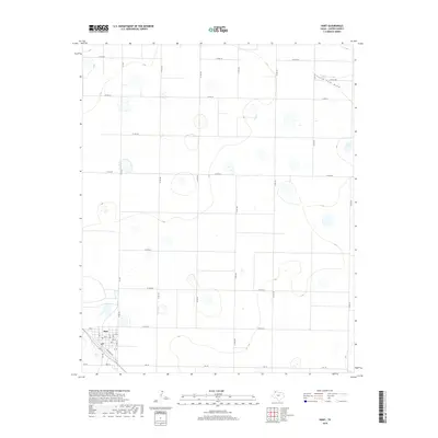
2019 Map of Hart
USGS Topo · Published 2019About this map
Hart anchors the southwest corner of this High Plains landscape, situated at the intersection of FM 168 and FM 145. The town's grid is clearly defined by local landmarks such as Main St, Railroad Ave, and a local Po. The surrounding terrain in Castro County is characterized by numerous small, scattered depressions and the intermittent drainage of South Tule Draw, which meanders across the northeast. This 2019 survey shows a highly organized section-line road system, including Co Rd 618 and Co Rd 531, reflecting the region's agricultural layout. The transition from the rural roads into the town center provides a clear view of the community's spatial organization and its relationship to the surrounding plains.
Find a feature on this map
26 named features on this map. Tap any name to fly to it.
Don’t see what you’re looking for? This feature index may not catch every label — zoom into the map to look around manually.
Map Details
Editions of this 2019 Hart Map
This is the sole edition of this map. No revisions or reprints were ever made.
Other maps of this area

1954 · Plainview
USGS Topo · 1:250,000

1954 · Clovis
USGS Topo · 1:250,000

1958 · Clovis
USGS Topo · 1:250,000

1958 · Plainview
USGS Topo · 1:250,000

1963 · Hart NW
USGS Topo · 1:24,000

1963 · Hart SW
USGS Topo · 1:24,000

1965 · Hart
USGS Topo · 1:24,000

1965 · Edmonson
USGS Topo · 1:24,000

1965 · Lakeview
USGS Topo · 1:24,000

1965 · Nazareth SW
USGS Topo · 1:24,000