2022 Map of Hart
USGS Topo · Published 2022About this map
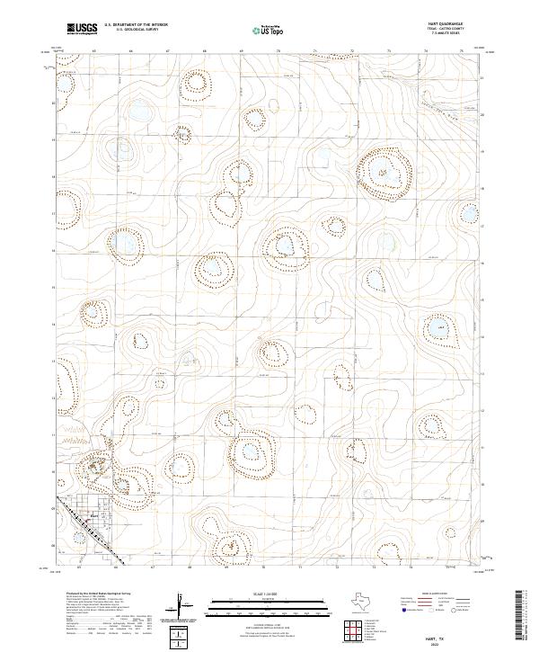
The settlement of Hart anchors the southwest corner of this High Plains landscape in Castro County. The town's grid is defined by a series of residential avenues, from Ave A through Ave F, and its local commerce is centered around Main St and the Po. The influence of early transportation and agriculture is evident in the presence of Railroad Ave and the extensive network of farm-to-market roads, including Fm 145 and Fm 168, which connect the town to the surrounding countryside. Outside the town limits, the terrain is characterized by numerous depressions and the winding path of South Tule Draw in the northeast. This 2022 survey illustrates the enduring agricultural structure of the Texas Panhandle, where a dense grid of county roads, such as Co RD 621 and Co RD 527, organizes the land into large, productive sections typical of the region's late-twentieth-century development.
Find a feature on this map
27 named features on this map. Tap any name to fly to it.
Don’t see what you’re looking for? This feature index may not catch every label — zoom into the map to look around manually.
Map Details
Editions of this 2022 Hart Map
This is the sole edition of this map. No revisions or reprints were ever made.
Other maps of this area

1954 · Plainview
USGS Topo · 1:250,000

1954 · Clovis
USGS Topo · 1:250,000

1958 · Clovis
USGS Topo · 1:250,000

1958 · Plainview
USGS Topo · 1:250,000

1963 · Hart NW
USGS Topo · 1:24,000

1963 · Hart SW
USGS Topo · 1:24,000

1965 · Hart
USGS Topo · 1:24,000

1965 · Edmonson
USGS Topo · 1:24,000

1965 · Lakeview
USGS Topo · 1:24,000

1965 · Nazareth SW
USGS Topo · 1:24,000