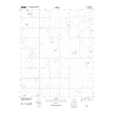
2009 Map of Hart
USGS Topo · Published 2009About this map
Corley Cemetery and Hart Cemetery sit within a landscape defined by an extensive water management network in this portion of Pontotoc County. The terrain is crisscrossed by numerous tributaries, including Little Canadian Sandy Creek and Guy Sandy Creek, which are punctuated by a series of flood control structures such as Sandy Creek Site 13 Dam and the Cherokee Sandy Site 8a Dam series. These dams and their associated reservoirs, like the Sandy Creek Site 13 Reservoir, illustrate the modern hydrologic engineering required to manage the watershed's runoff.
Find a feature on this map
42 named features on this map. Tap any name to fly to it.
Don’t see what you’re looking for? This feature index may not catch every label — zoom into the map to look around manually.
Map Details
Editions of this 2009 Hart Map
This is the sole edition of this map. No revisions or reprints were ever made.
Other maps of this area

1898 · Pauls Valley
USGS Topo · 1:125,000

1901 · Stonewall
USGS Topo · 1:125,000

1902 · Pauls Valley
USGS Topo · 1:125,000

1957 · Ardmore
USGS Topo · 1:250,000

1963 · Ardmore
USGS Topo · 1:250,000

1964 · Byars
USGS Topo · 1:24,000

1965 · Pauls Valley NE
USGS Topo · 1:24,000

1965 · Davis
USGS Topo · 1:24,000

1967 · Roff South
USGS Topo · 1:24,000
1967 · Vanoss
USGS Topo · 1:24,000