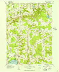
1954 Map of Hartfield
USGS Topo · Published 1956About this map
Chautauqua Lake and its northern inlets anchor this mid-1950s survey of New York's western interior. The settlement of Hartfield sits at the junction of the Pennsylvania railroad and the marshes of the Big Inlet, while the northern shores of Chautauqua Lake stretch toward Mayville and the seasonal retreats at Wooglin and the Triangle Camp. The terrain reveals a transition from the agricultural lowlands near Skinners Switch to the rising elevations of Howard Hill, where local landmarks like the Howard Hill Ch and Elm Flats Ch served rural congregations.
Find a feature on this map
53 named features on this map. Tap any name to fly to it.
Don’t see what you’re looking for? This feature index may not catch every label — zoom into the map to look around manually.
Map Details
Editions of this 1954 Hartfield Map
2 editions found
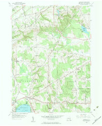
Other maps of this area

1899 · Westfield
USGS Topo · 1:62,500

1900 · Dunkirk
USGS Topo · 1:62,500

1904 · Chautaqua
USGS Topo · 1:62,500

1905 · Clymer
USGS Topo · 1:62,500

1939 · Clymer
USGS Topo · 1:62,500

1941 · Chautauqua
USGS Topo · 1:62,500

1941 · Clymer
USGS Topo · 1:62,500

1943 · Dunkirk
USGS Topo · 1:62,500

1954 · Chautauqua
USGS Topo · 1:24,000

1954 · Ellery Center
USGS Topo · 1:24,000