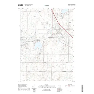
2018 Map of Hartford East
USGS Topo · Published 2018About this map
Hartford and Slinger serve as the primary hubs in this part of Washington County, where the landscape is defined by its glacial hydrology. The waters of Pike Lake and the Rubicon River dominate the central topography, while the Oconomowoc River and Flynn Cr flow through the southern reaches near Richfield. This era of development shows a network of established crossroads and rural hamlets, including Saint Lawrence to the north and the cluster at Ackerville. Local history and genealogy interest is anchored by several burial sites, such as Union Cem and Old Saint Peter Cem, which sit near the shifting elevations of the Kettle Moraine. The presence of Hartford Millpond 32 reflects the historical importance of water management in supporting the local economy and early industry along the riverbanks.
Find a feature on this map
134 named features on this map. Tap any name to fly to it.
Don’t see what you’re looking for? This feature index may not catch every label — zoom into the map to look around manually.
Map Details
Editions of this 2018 Hartford East Map
This is the sole edition of this map. No revisions or reprints were ever made.
Other maps of this area

1892 · Waukesha
USGS Topo · 1:62,500

1892 · Oconomowoc
USGS Topo · 1:62,500

1901 · Waukesha
USGS Topo · 1:62,500

1904 · West Bend
USGS Topo · 1:62,500

1904 · Hartford
USGS Topo · 1:62,500

1906 · Waukesha
USGS Topo · 1:62,500

1909 · Oconomowoc
USGS Topo · 1:62,500

1957 · Madison
USGS Topo · 1:250,000

1959 · West Bend
USGS Topo · 1:62,500
1959 · Stonebank
USGS Topo · 1:24,000