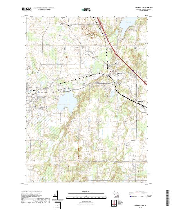
2022 Map of Hartford East
USGS Topo · Published 2022About this map
Pike Lake serves as a central landmark for this portion of Washington County, anchoring a landscape where the Rubicon River and Ashippun River begin their winding courses. The settlement patterns shown here reflect the region's agricultural and industrial roots, with Hartford and Slinger serving as primary hubs. Local history is etched into the landscape at Saint Lawrence and Ackerville, where longstanding community foundations are marked by Saint Lawrence Cem and Ackerville Cem.
Find a feature on this map
48 named features on this map. Tap any name to fly to it.
Don’t see what you’re looking for? This feature index may not catch every label — zoom into the map to look around manually.
Map Details
Editions of this 2022 Hartford East Map
This is the sole edition of this map. No revisions or reprints were ever made.
Historical Maps of Erin Through Time
4 maps found