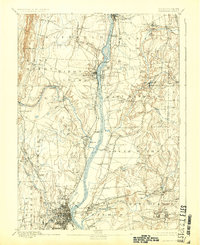
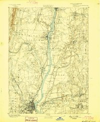
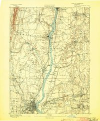
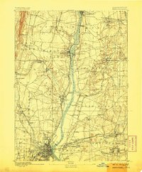
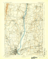
1892 Map of Hartford
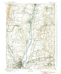
USGS Topo · Published 1925About this map
The Connecticut River serves as the central artery for this late nineteenth-century landscape, dictated by the flow of water and the reach of the rail. The industrial character of the region is evident at Windsor Locks and near Vintons Mills, while river crossings like the Enfield Bridge and the Bissell Ferry connect the developing townships. On the eastern bank, the New York and New England RR links smaller settlements such as Burnside and Buckland, while the western side is dominated by the Hartford Division line passing through Windsor.
Find a feature on this map
76 named features on this map. Tap any name to fly to it.
Don’t see what you’re looking for? This feature index may not catch every label — zoom into the map to look around manually.
Map Details
Editions of this 1892 Hartford Map
8 editions found

Other maps of this area

1886 · Springfield
USGS Topo · 1:62,500

1887 · Palmer
USGS Topo · 1:62,500

1887 · Granville
USGS Topo · 1:62,500

1889 · Springfield
USGS Topo · 1:62,500

1889 · Palmer
USGS Topo · 1:62,500

1889 · Granville
USGS Topo · 1:62,500

1892 · Hartford
USGS Topo · 1:62,500

1892 · Tolland
USGS Topo · 1:62,500

1892 · Meriden
USGS Topo · 1:62,500

1892 · Granby
USGS Topo · 1:62,500