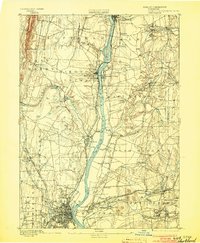
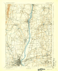
1892 Map of Hartford
USGS Topo · Published 1903About this map
The Connecticut River serves as the central artery for this late 19th-century landscape, bisecting a region defined by industrial river towns and active transport corridors. From the prominent heights of Peak Mountain in the northwest to the developing urban footprint of Hartford in the south, the map illustrates an era when water power and rail transit were paramount. The presence of Bissel Ferry provides evidence of traditional river crossings surviving alongside the expanding Hartford Division New York New Haven and Hartford Railroad. Small manufacturing and milling centers are scattered throughout the quadrangle, including Warehouse Point, Hazardville, and Windsor Locks. The network of streams like Broad Brook and Ketch Brook feeding into the main river channel highlights the importance of local topography to the settlement patterns of towns like Manchester and South Windsor before the onset of modern suburbanization.
Find a feature on this map
69 named features on this map. Tap any name to fly to it.
Don’t see what you’re looking for? This feature index may not catch every label — zoom into the map to look around manually.
Map Details
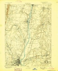
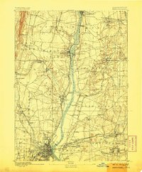
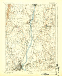
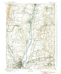
Editions of this 1892 Hartford Map
8 editions found

Other maps of this area

1886 · Springfield
USGS Topo · 1:62,500

1887 · Palmer
USGS Topo · 1:62,500

1887 · Granville
USGS Topo · 1:62,500

1889 · Springfield
USGS Topo · 1:62,500

1889 · Palmer
USGS Topo · 1:62,500

1889 · Granville
USGS Topo · 1:62,500

1892 · Hartford
USGS Topo · 1:62,500

1892 · Tolland
USGS Topo · 1:62,500

1892 · Meriden
USGS Topo · 1:62,500

1892 · Granby
USGS Topo · 1:62,500