
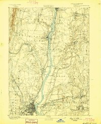
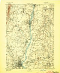
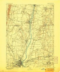
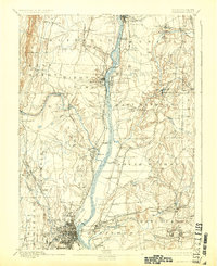
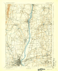
1892 Map of Hartford
USGS Topo · Published 1910About this map
The Connecticut River serves as the central artery for this late 19th-century landscape, flanked by a dense network of industrial and agricultural settlements. The map highlights the reliance on water power and river crossings before the age of modern highway bridges, specifically noting the Bissell Ferry and the Enfield Bridge near Kings Island. To the east and west, the rail network is well-established, including the Hartford Div. N.Y.N.H. & H. R.R. and the New York and New England Railroad. Small mill enclaves such as Sadds Mills, Vintons Mills, and Rainbow dot the smaller tributaries like the Scantic River and Farmington River. The street grid of the city of Hartford is intricately detailed at the southern edge, showing the early urban footprint of the state capital as it transitions into the rural townships of Windsor and Bloomfield.
Find a feature on this map
75 named features on this map. Tap any name to fly to it.
Don’t see what you’re looking for? This feature index may not catch every label — zoom into the map to look around manually.
Map Details
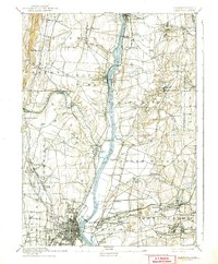
Editions of this 1892 Hartford Map
8 editions found
Other maps of this area

1886 · Springfield
USGS Topo · 1:62,500

1887 · Palmer
USGS Topo · 1:62,500

1887 · Granville
USGS Topo · 1:62,500

1889 · Springfield
USGS Topo · 1:62,500

1889 · Palmer
USGS Topo · 1:62,500

1889 · Granville
USGS Topo · 1:62,500

1892 · Hartford
USGS Topo · 1:62,500

1892 · Tolland
USGS Topo · 1:62,500

1892 · Meriden
USGS Topo · 1:62,500

1892 · Granby
USGS Topo · 1:62,500