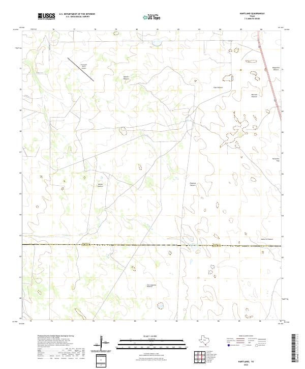
2022 Map of Hartland
USGS Topo · Published 2022About this map
The boundary between Brooks County and Hidalgo County bisects this ranching landscape in South Texas, where large-scale land divisions and water management define the terrain. The presence of the El Coyote Ranch Airport in the northwest corner highlights the connectivity required for these expansive private holdings. The naming conventions of the area reflect local heritage and land use, with numerous named pastures such as Patitos Pasture, Vargas Pasture, and Tres Lagunas Pasture organized around intermittent water features like Vargas Cr and Tasajal Lake. A small network of county roads, including Co RD 310 and Co RD 311, provides access to these working lands, while the primary transport corridor of Highway 281 skirts the eastern edge of the quadrangle.
Find a feature on this map
17 named features on this map. Tap any name to fly to it.
Don’t see what you’re looking for? This feature index may not catch every label — zoom into the map to look around manually.
Map Details
Editions of this 2022 Hartland Map
This is the sole edition of this map. No revisions or reprints were ever made.
Other maps of this area

1939 · Linn
USGS Topo · 1:62,500

1939 · La Reforma
USGS Topo · 1:62,500

1939 · Encantada
USGS Topo · 1:62,500

1949 · Mc Allen
USGS Topo · 1:250,000

1954 · McAllen
USGS Topo · 1:250,000

1957 · Mc Allen
USGS Topo · 1:250,000

1962 · McAllen
USGS Topo · 1:250,000
1963 · Callo Padrones
USGS Topo · 1:24,000
1963 · Encino
USGS Topo · 1:24,000

1963 · Linn NW
USGS Topo · 1:24,000