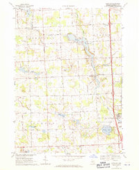
1968 Map of Hartland
USGS Topo · Published 1971About this map
Parshallville and Hartland anchor this mid-Michigan landscape, where the waters of North Ore Creek feed into the Hartland Millpond. The topography reflects a post-war rural environment defined by small lakes and established farming communities across Deerfield and Hartland townships. The map documents numerous local landmarks of value to family historians, including the Deerfield Center Cem, St Augustine Ch, and Smith Cem.
Find a feature on this map
44 named features on this map. Tap any name to fly to it.
Don’t see what you’re looking for? This feature index may not catch every label — zoom into the map to look around manually.
Map Details
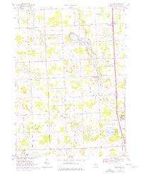
Editions of this 1968 Hartland Map
2 editions found
Other maps of this area

1907 · Howell
USGS Topo · 1:62,500

1909 · Howell
USGS Topo · 1:62,500

1909 · Milford
USGS Topo · 1:62,500

1920 · Holly
USGS Topo · 1:62,500

1922 · Holly
USGS Topo · 1:62,500

1922 · Durand
USGS Topo · 1:62,500

1943 · Holly
USGS Topo · 1:62,500

1943 · Durand
USGS Topo · 1:62,500

1954 · Detroit
USGS Topo · 1:250,000

1961 · Detroit
USGS Topo · 1:250,000
Featured Places
- Hartland Township, MI
- Oceola Township, MI
- Tyrone Township, MI
- Deerfield Township, MI
- Deerfield Center, Deerfield Township