
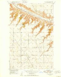
1949 Map of Hartland
USGS Topo · Published 1949About this map
Hartland sits at the crossing of the Great Northern railroad, serving as a vital rail node in this 1940s landscape. The settlement is surrounded by an organized grid of section lines that underscore the agricultural identity of Ward and Renville Counties. Education and community life are grounded at sites like Viola School No 1 and several local burial grounds, including Zion Cem and Johnson Cem.
Find a feature on this map
16 named features on this map. Tap any name to fly to it.
Don’t see what you’re looking for? This feature index may not catch every label — zoom into the map to look around manually.
Map Details
Editions of this 1949 Hartland Map
2 editions found
Other maps of this area

1947 · Tolley
USGS Topo · 1:62,500

1948 · Donnybrook
USGS Topo · 1:24,000

1949 · Tolley SE
USGS Topo · 1:24,000

1949 · Carpio
USGS Topo · 1:24,000

1949 · Grano SW
USGS Topo · 1:24,000

1950 · Tolley
USGS Topo · 1:62,500
1951 · Grano
USGS Topo · 1:62,500

1954 · Minot
USGS Topo · 1:250,000

1958 · Minot
USGS Topo · 1:250,000

1980 · Minot
USGS Topo · 1:100,000